Наші кейси

Виберіть направлення:
Thank you! Your submission has been received!
Oops! Something went wrong while submitting the form.

Creation of BIM models of railway stations

BIM
3D
Point Cloud
Revit
The project was implemented to document railway stations или to perform an inventory of railway stations.

BIM Model for Planning Noise Barriers Along Railway Lines

BIM
3D
Point Cloud
Revit
Specialists at Archizem developed a BIM model to support the planning of noise barriers along an 8 km railway section that runs both through built-up areas and outside settlements. The model represents the current condition of the infrastructure and provides a reliable basis for further design decisions.

BIM Model of a Railway Section with a Bridge and an Underpass

BIM
3D
Point Cloud
Revit
Archizem specialists developed a BIM model of a railway section that includes a bridge and a grade-separated underpass. The model captures the asset’s current condition and provides a reliable baseline for subsequent design work and reconstruction planning.

BIM Model of a Railway Station for Inventory and Reconstruction Planning

BIM
3D
Point Cloud
Revit
Archizem specialists developed a BIM model of a railway station that reflects its as-is condition and serves as a reliable baseline for inventory purposes and future infrastructure development. The model provides the Client with a practical tool for technical analysis, modernization planning, and optimization of operational workflows.

High-Accuracy BIM Model of a Railway Station

BIM
3D
Point Cloud
Revit
As part of an inventory of railway-line assets, the Archizem Group developed a BIM model of a railway station that reflects the actual (as-built) condition of the infrastructure. The model can be used as a reliable basis for further design, technical analysis, and reconstruction planning.

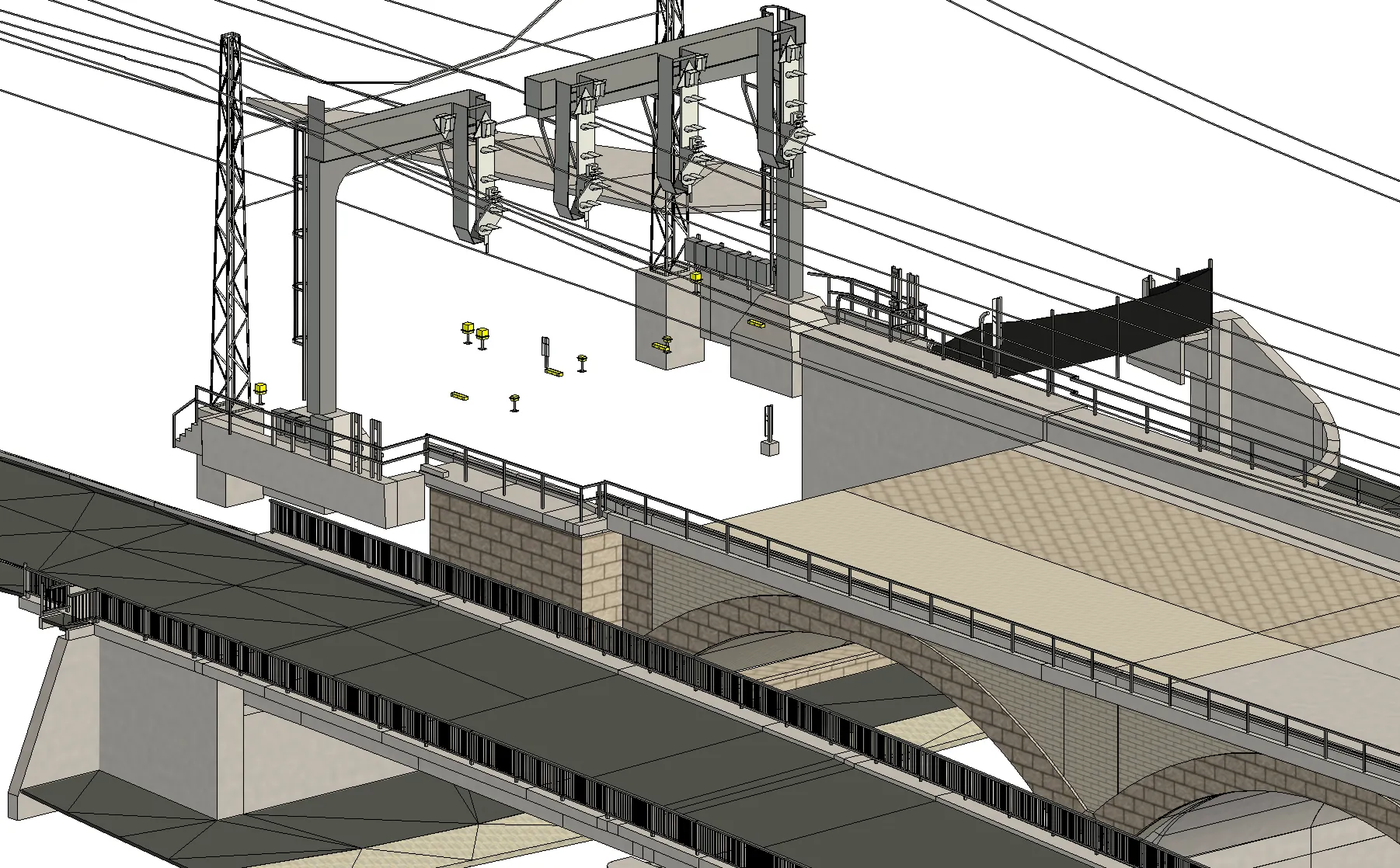
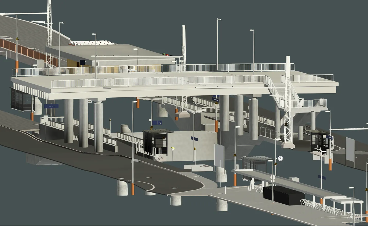
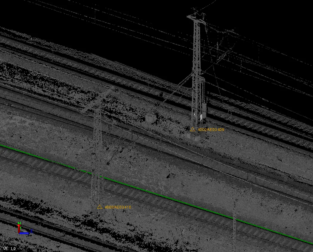
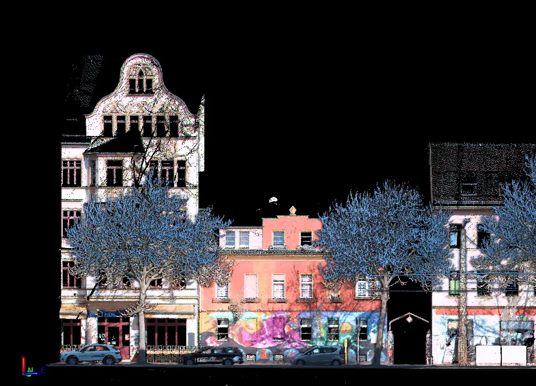
Point Cloud Classification for Urban Infrastructure

Point Cloud
Trimble Business Center
To prepare data along a tramway corridor, Archizem carried out point cloud classification based on datasets captured with the Trimble MX9 mobile scanning system. During processing, the main object classes were identified, including buildings, dynamic objects, road surface, ground, vegetation, noise, and other urban features.

Point Cloud Registration Along the Rail Network

Point Cloud
Trimble Business Center
Archizem specialists registered point clouds captured with the Trimble MX9 mobile mapping system during rail infrastructure scanning. As acquisition was performed in motion, the trajectory was refined and absolute accuracy improved using survey targets (targets) fixed on the ground and/or on structures. The achieved registration accuracy was up to 3 cm.

Point Cloud Registration Along Tramway Tracks

Point Cloud
Trimble Business Center
The Archizem engineering team completed point cloud registration based on data captured with the Trimble MX9 mobile mapping system during tram network scanning. Since the survey was performed in motion, geodetic control points were used to refine the trajectory and ensure reliable georeferencing. The achieved registration accuracy was up to 1–2 cm.

Receive a data audit and report within 24 hours.

Leave a request

We will check your materials for free (point clouds, DWG, GeoTIFF, etc.) and provide a calculation of budget and deadlines within 24 hours
Grazie! Your submission has been received!
We have received your request and will contact you shortly
Oops! Something went wrong. Please try again.
0
%