Choose the desired direction and get an accurate engineering result
Drawings and 2D modeling in CAD
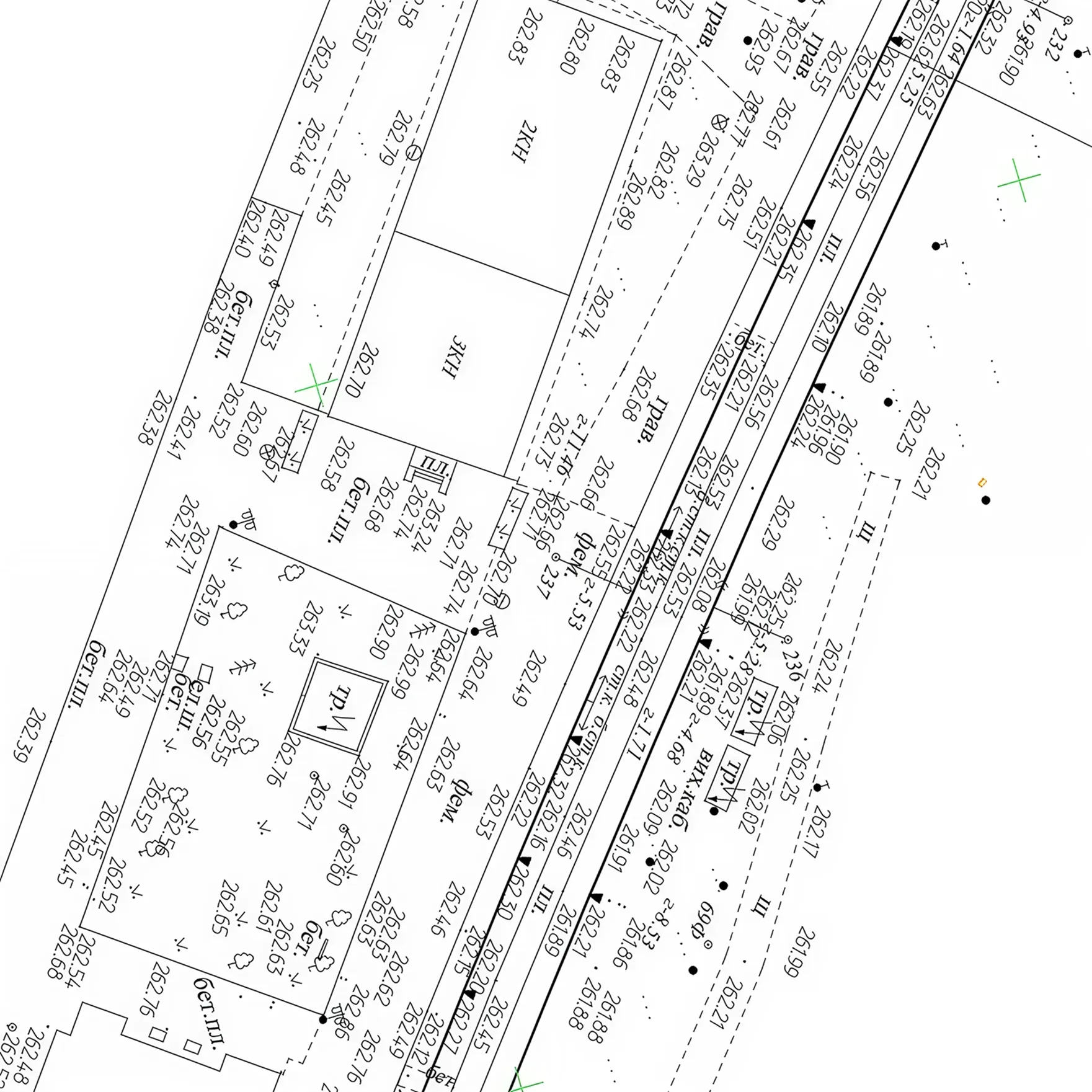
From point clouds or geodetic measurements to ready-made drawings — engineering, topographic and architectural plans and profiles, digital terrain and terrain models, etc. The documentation complies with international standards and integrates into your CAD, GIS or CAFM systems.
Development of design and estimate documentation for new construction, reconstruction, major repairs and restoration of objects — we create technical solutions that comply with current DBN and international standards
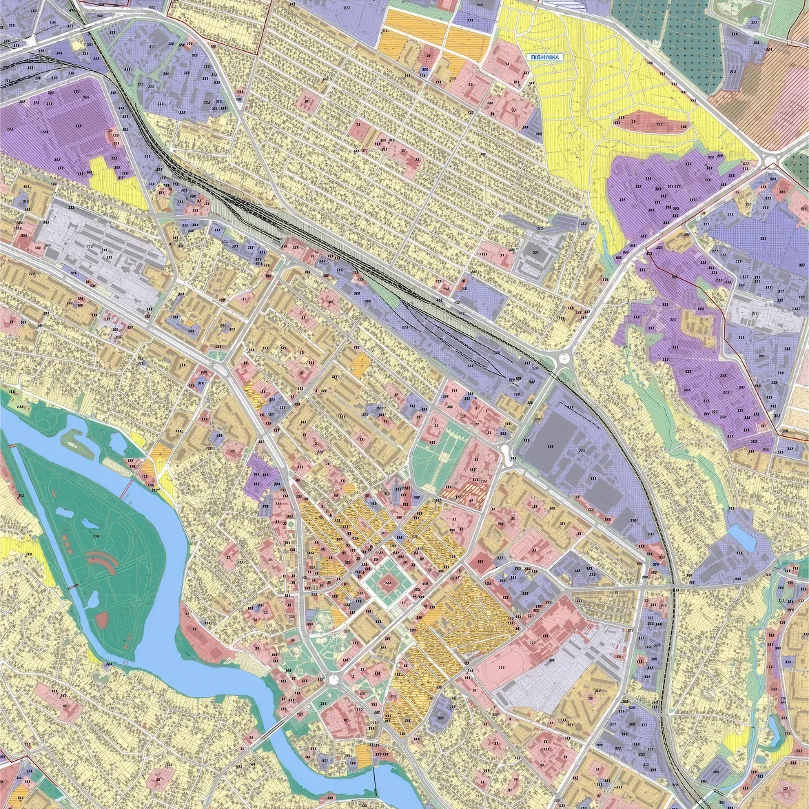
Comprehensive spatial development plans of the territory, master plans of cities and villages, detailed plans of the territory, historical and architectural reference plans — we develop spatial solutions that shape the future of your communities.
From “raw data” to the finished result — turnkey and without searching for additional contractors.
01
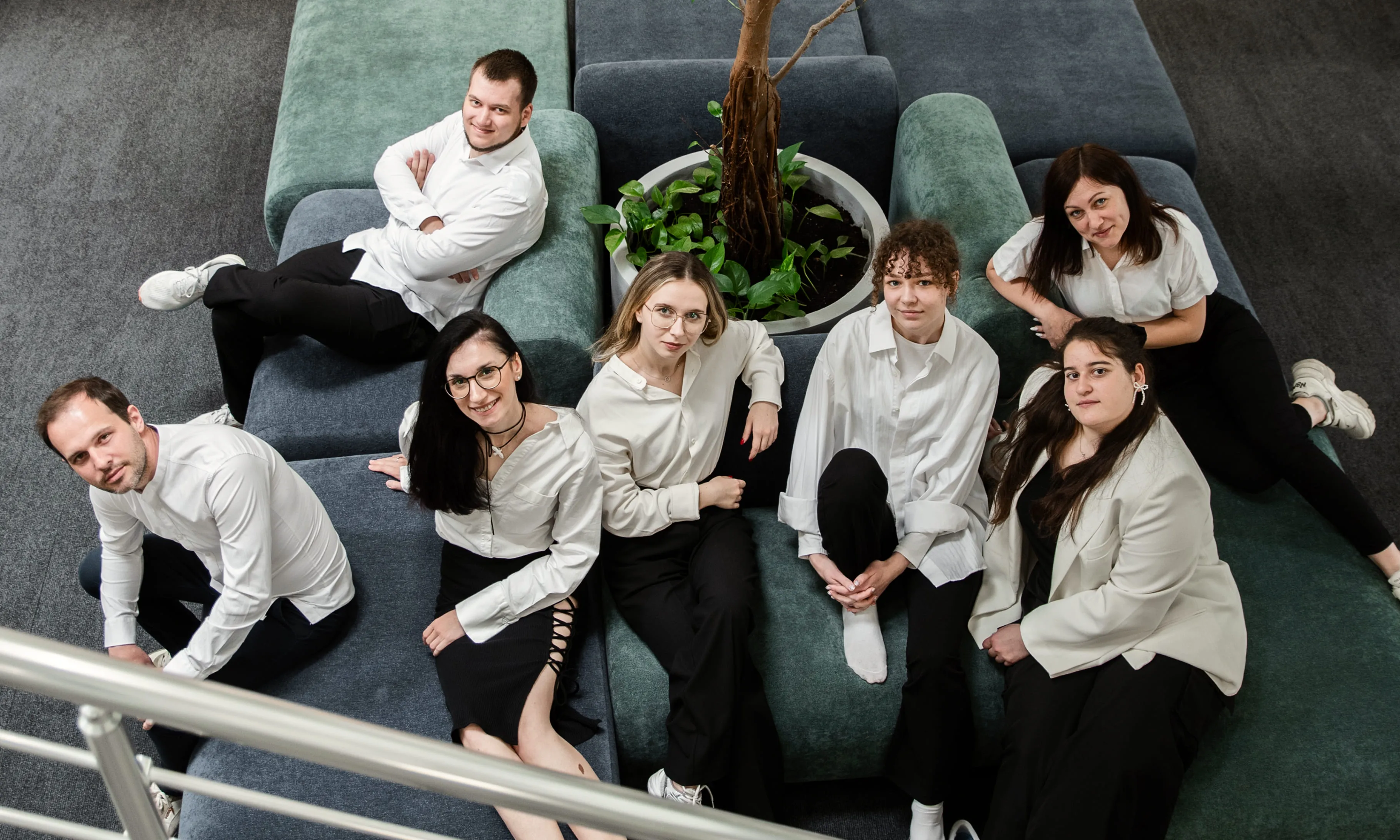
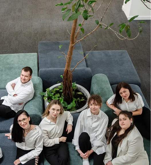
9 years of experience and 75+ experts
Since 2016, a team of surveyors, BIM/CAD specialists, land surveyors and architects has been implementing complex projects of any scale.
02
4000+ completed projects
We understand your problems, because we have already solved such problems. Experience in various fields = accurate assessment and result without modification.
03
Compliance with international standards
Our quality, information security and environmental management systems comply with international standards ISO 9001, 14001 and 27001
04
Full transparency
Regular reports, direct contact with the team and access to Jira Atlassian — you see the process in real time.
05
Free pilot project
Try our approach and quality of work before signing the contract.
We understand your problems, because we have already solved such problems. Experience in various fields = accurate assessment and result without modification.
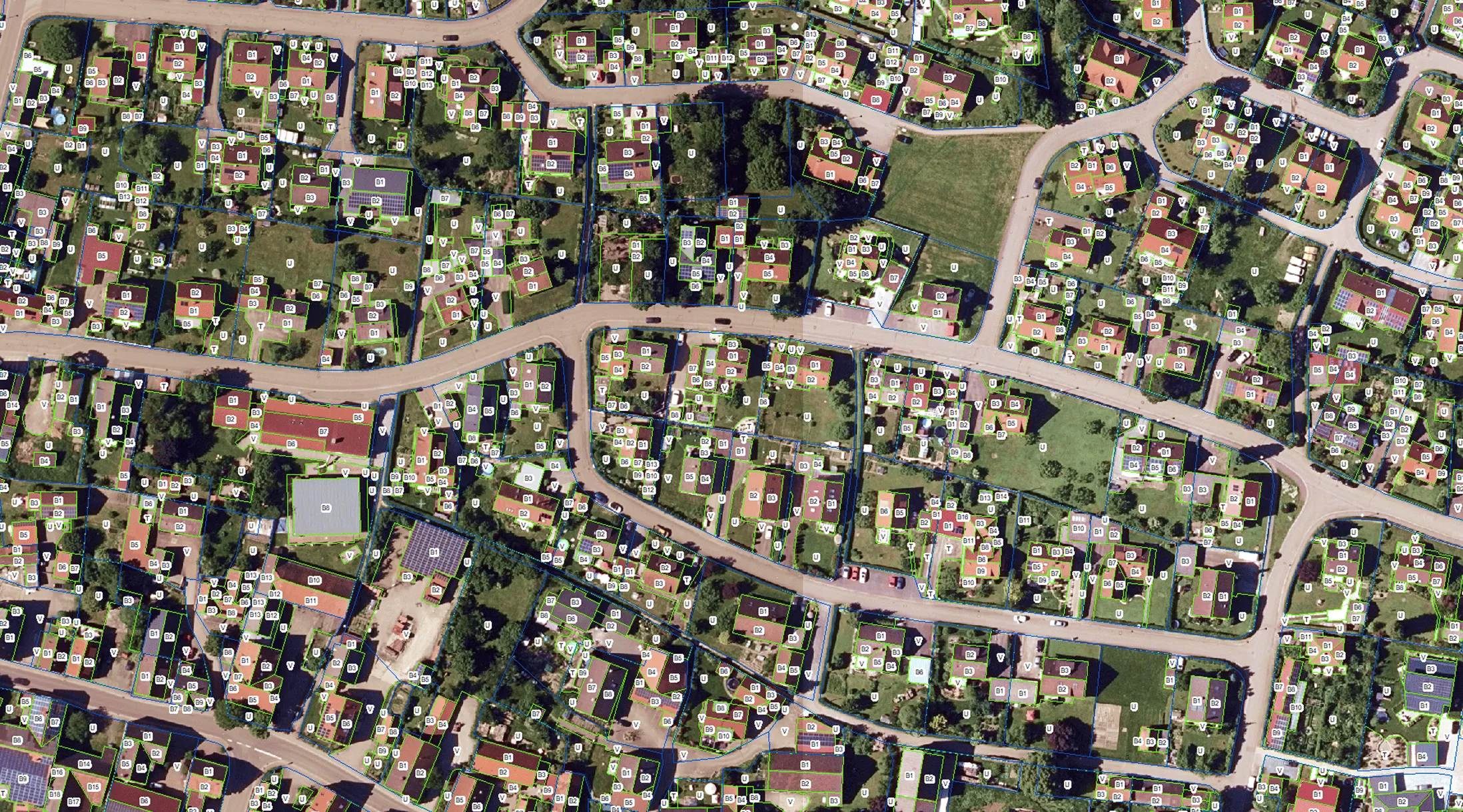
The aim of the project was to create a digital map showing all impervious and pervious surfaces in a given area, including roads, buildings and other technical and plant structures.
more details
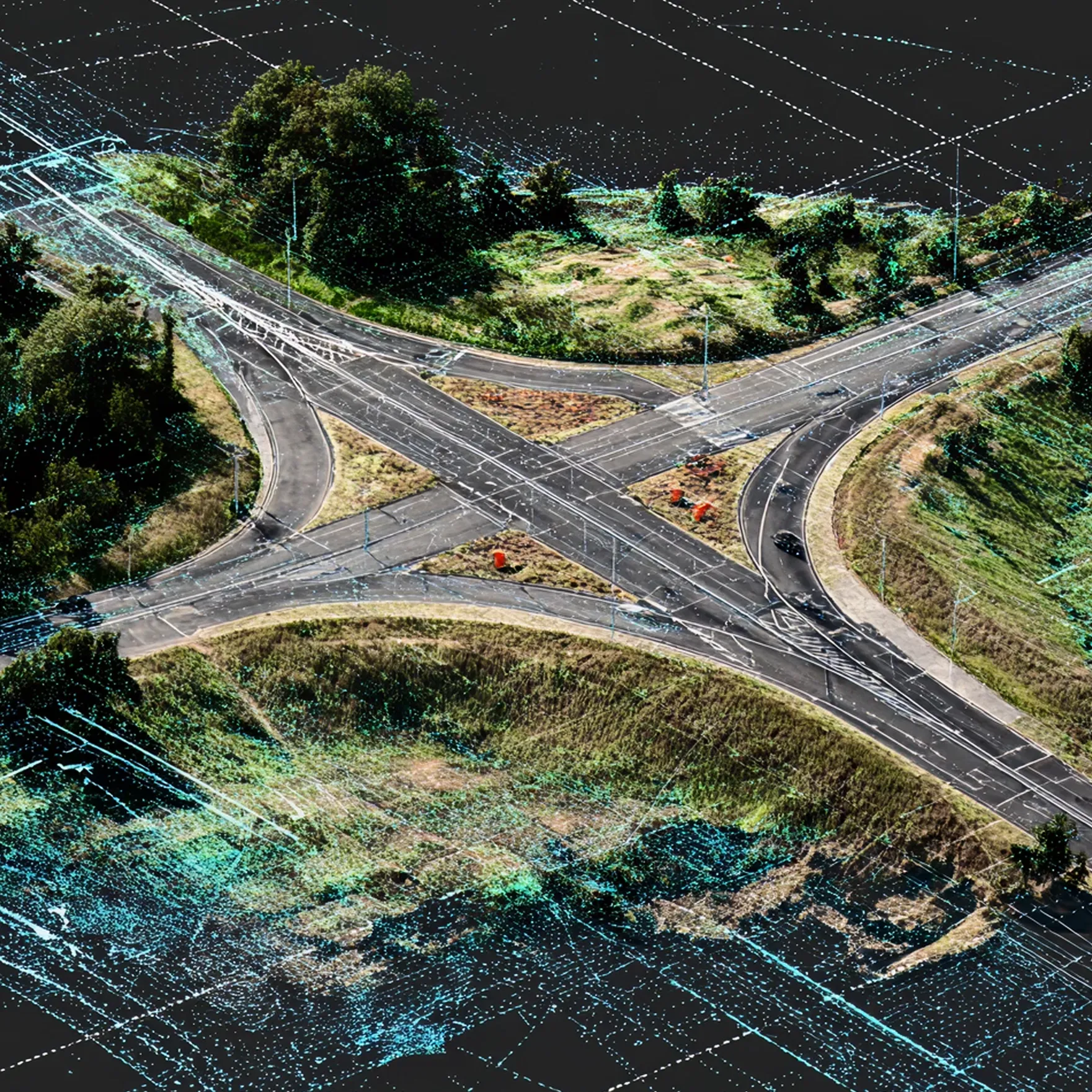
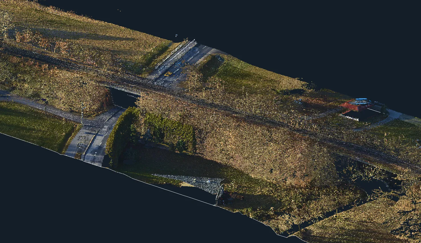
Cross-Section Profiles of a Railway Track Based on Point Clouds
Civil 3D
Point Cloud
Digital Terrain Models
Archizem’s engineering team produced accurate cross-section profiles for a railway track section using point-cloud data. To achieve the required accuracy, mobile laser scanning data captured with the Trimble MX9 system were combined with total station survey results. This workflow provided highly reliable and detailed source information.
more details
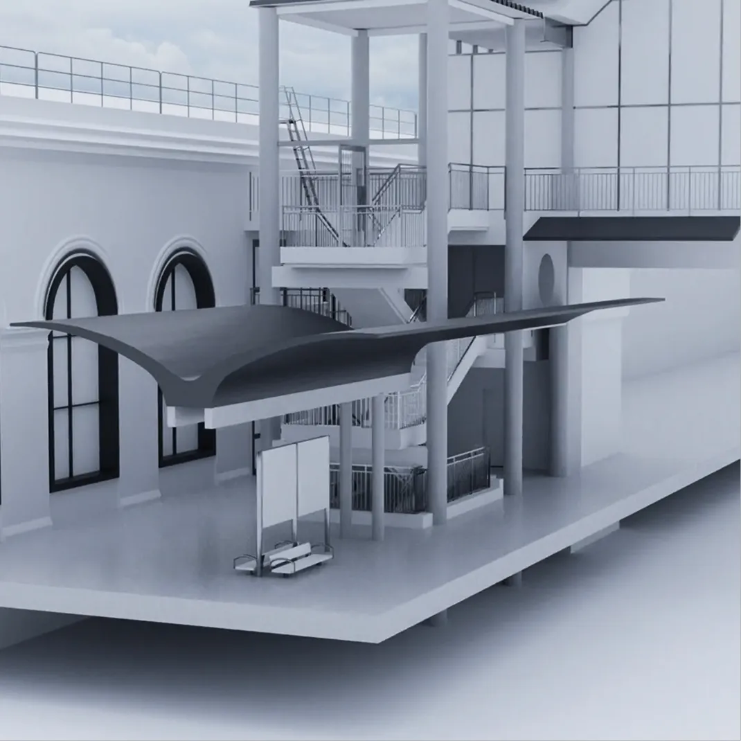
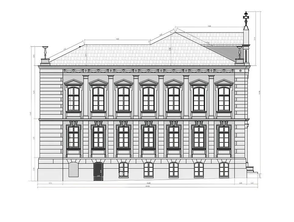
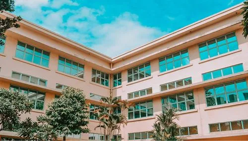
Architectural drawings of a school building
CAD
Аrchitectural drawing
Point Cloud
A set of 2D CAD drawings (elevations and sections) of a school building in Germany was prepared by Archizem specialists based on a point cloud. The deliverables were produced to accurately document the asset and to provide baseline data for future refurbishment and modernization works.
more details
Evaluate our approach on a real task
Leave a request
We will complete the pilot project for free and quickly. We are sure you will appreciate our accuracy, speed and quality
Grazie! Your submission has been received!
We have received your request and will contact you shortly
Oops! Something went wrong. Please try again.
Archizem is the first Ukrainian company of international level in the fields of digital transformation and design
4000+ successfully completed projects
team of 75+ experts, international certification and streamlined and transparent processes — all this is the key to a quality result in the agreed years.
We will check your materials for free (point clouds, DWG, GeoTIFF, etc.) and provide a calculation of budget and deadlines within 24 hours
Thank you!
We have received your request and will contact you shortly
Oops! Something went wrong. Please try again.
FAQ
What file formats do you work with?
We accept all major formats: point clouds (LAS, LAZ, E57, RCP/RCS, PTS, XYZ), drawings (DWG, DXF), geodata (SHP, GDB, GeoTIFF), BIM models (RVT, IFC). If the format is non-standard, we will perform the conversion or adjust the process to your data.
Do you adapt the projects to the standards of my country?
Yes. Before starting work, we agree on requirements, standards, templates and file structure. The final result always meets the norms and standards of the customer's country.
How do you guarantee the accuracy of models and drawings?
We apply multi-level quality control. If necessary, we provide official reports of internal inspections.
How does interaction occur in cooperation?
Your request → appointment of the manager → clarification of details and approval of the vehicle → calculation of the budget and deadlines → conclusion of the contract. Further, the manager provides constant communication until the final results are transmitted to you, after which you pay for the work.
Can I order a pilot/test project?
Yes. We will perform a test task (up to 24 hours of work) free of charge: BIM model, plan, digital terrain model, etc. This makes it possible to assess our level without financial risks.
How long does it take to complete my project?
Within 24 hours after receiving the materials, we will provide a cost calculation, an exact schedule and deadlines for the project.
What languages can you communicate with your team?
We communicate in Ukrainian, English and German. We prepare technical documentation in the customer's language.
How do I get the finished files?
We transfer the results via secure cloud services or corporate FTP. Files are structured according to an agreed template, archived and have quality control. If necessary, we sign NDAs and comply with your security policies.
Is it possible to work with you on a long-term basis?
Yes. For many customers, we work as an external technical team. In this case, we integrate into your internal systems and environments and comply with your organizational processes. This will save you time and money, while guaranteeing stable quality in long-term cooperation.
How is the cost of your services formed?
The cost is determined individually: it depends on the type of task, the amount of data, complexity and urgency. Initial data audit and price calculation are free of charge and provided within 24 hours.