Наші кейси

Виберіть направлення:
Thank you! Your submission has been received!
Oops! Something went wrong while submitting the form.

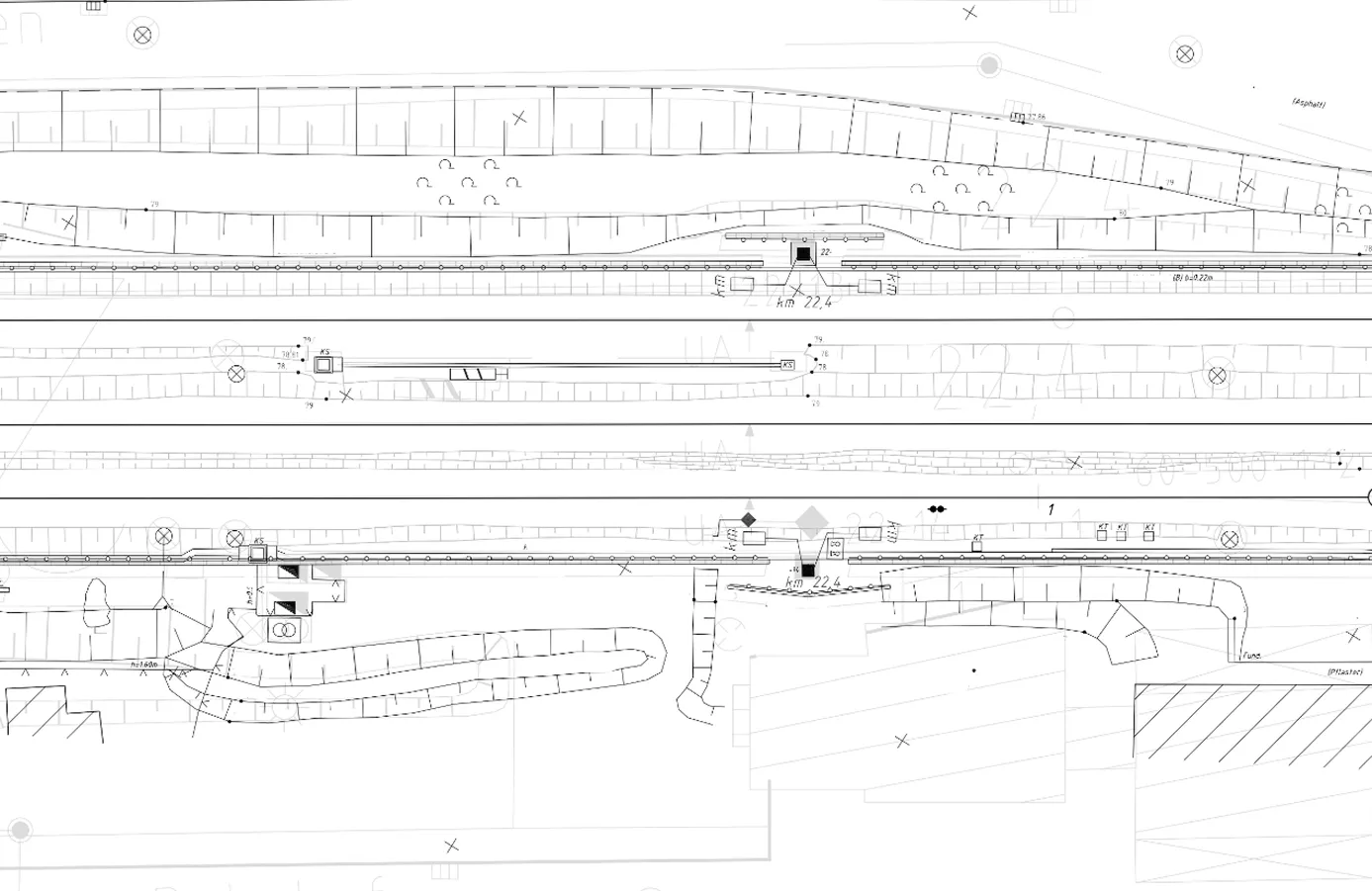
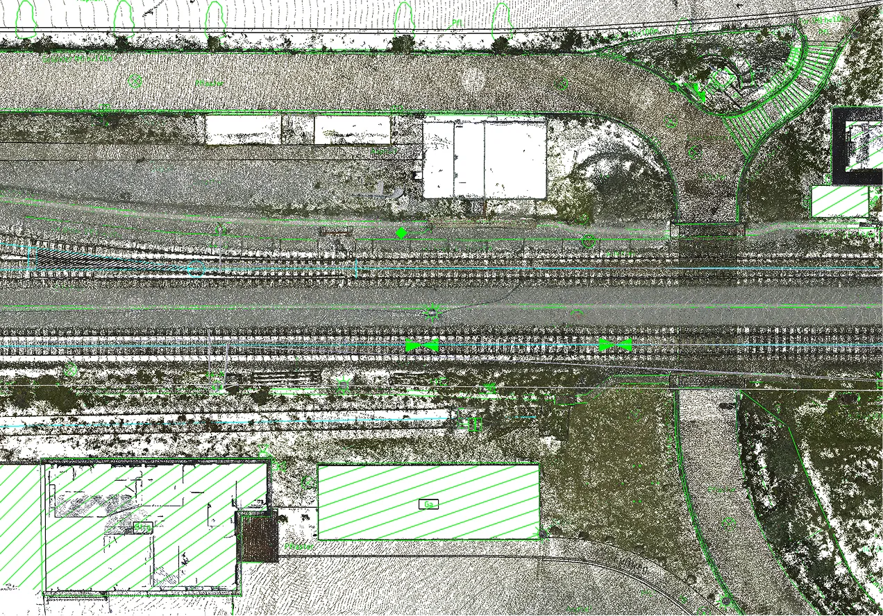
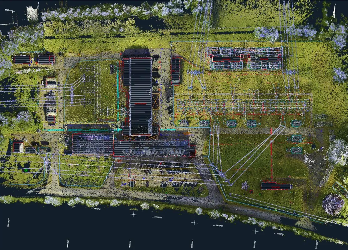
Topographic Plans (1:200) for 95 Railway Level Crossings

Civil 3D
Point Cloud
Topography
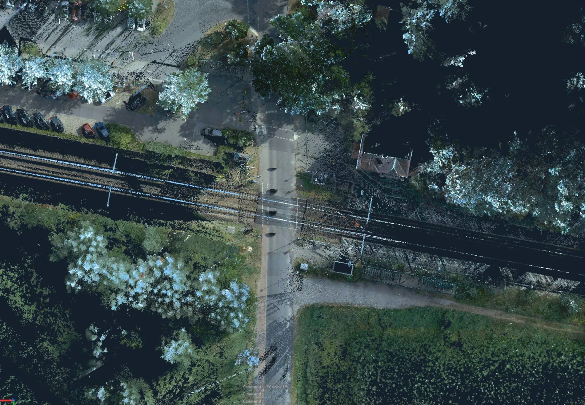
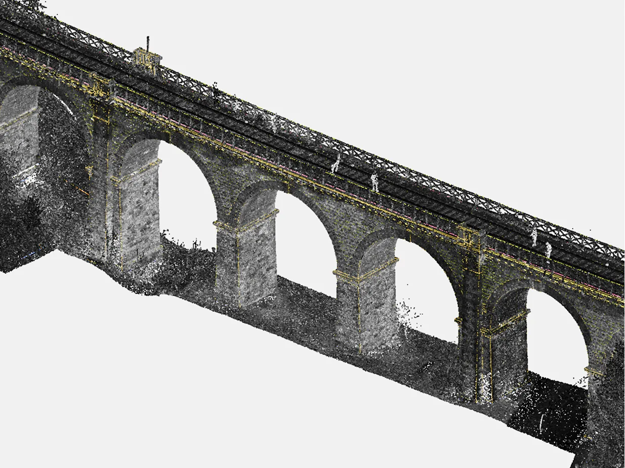
A comprehensive set of office-based (cameral) topographic and geodetic works was completed by Archizem, and 95 topographic plans for railway level crossings were produced at a scale of 1:200. For each location, elements of transport and engineering infrastructure, as well as the surrounding areas within the project limits, were captured in detail.

Topographic Plan (1:200) for the Reconstruction of Railway Infrastructure Facilities

Civil 3D
Point Cloud
Topography
A comprehensive set of office-based topographic and geodetic data processing works was completed by Archizem, and a 1:200 topographic plan was produced for a railway corridor approximately 4.75 km long and up to 60 m wide. Within the project limits, elements of railway and engineering infrastructure, as well as adjacent areas, were captured in detail.

Topographic Plan (1:250) for Updating Design Documentation

Civil 3D
Point Cloud
Topography
To support the update of design documentation, Archizem prepared a 1:250 topographic plan for a corridor approximately 1.0 km long and up to 70 m wide. Within the project limits, elements of engineering infrastructure and adjacent areas were mapped in detail.

3D As-Built Plan of the Railway Bridge

Point Cloud
Civil 3D
3D-plan
To assess the bridge’s current technical condition, Archizem prepared a 3D as-built plan that enables a detailed review of the structure’s geometry and key structural components.

Topographic Plan (1:500) for Updating Design Documentation

Civil 3D
Point Cloud
Topography
To support the update of design documentation, Archizem prepared a 1:500 topographic plan for a 3.5 ha electrical substation site. Within the project limits, key elements of engineering infrastructure and adjacent areas were mapped in detail.

Architectural Drawings for an Office Building Based on a Point Cloud (CAFM)

CAD
Аrchitectural drawing
Point Cloud
A complete set of architectural drawings for an office building was developed by the Archizem team based on a laser-scanning point cloud for a German company specializing in Computer-Aided Facility Management (CAFM). The primary objective of the project was to create an accurate graphical baseline for facility management, refurbishment planning, and technical maintenance of the building.

Architectural Drawings for a Residential Building Based on a Point Cloud (CAFM)

CAD
Аrchitectural drawing
CAFM
Point Cloud
A full set of architectural drawings for a residential building in France was prepared by Archizem specialists using a laser-scanning point cloud. The work was delivered for a French real-estate and facilities management company operating with Computer-Aided Facility Management (CAFM) tools, with the aim of accurately capturing the building geometry for ongoing facility management and future refurbishment planning.

Architectural Drawings of a Historic Cathedral in CAD Format

CAD
Аrchitectural drawing
Point Cloud
A comprehensive set of 2D CAD drawings of a historic cathedral in Spain was developed by Archizem’s engineering team based on a laser-scanning point cloud. The project supports the preservation of architectural heritage and provides a precise graphic baseline for restoration and research activities.

Receive a data audit and report within 24 hours.

Leave a request

We will check your materials for free (point clouds, DWG, GeoTIFF, etc.) and provide a calculation of budget and deadlines within 24 hours
Grazie! Your submission has been received!
We have received your request and will contact you shortly
Oops! Something went wrong. Please try again.
0
%